

State Route 62 wildlife crossings
Two wildlife crossings for the California desert
The Mojave Desert Land Trust is leading the planning and design of two wildlife crossings over State Route 62 in the California desert. A three-year project is underway thanks to state and agency funding. The crossings will benefit local residents by reducing wildlife-vehicle collisions and will provide safe passage for numerous wildlife species, including two threatened mountain lion populations.
In the news







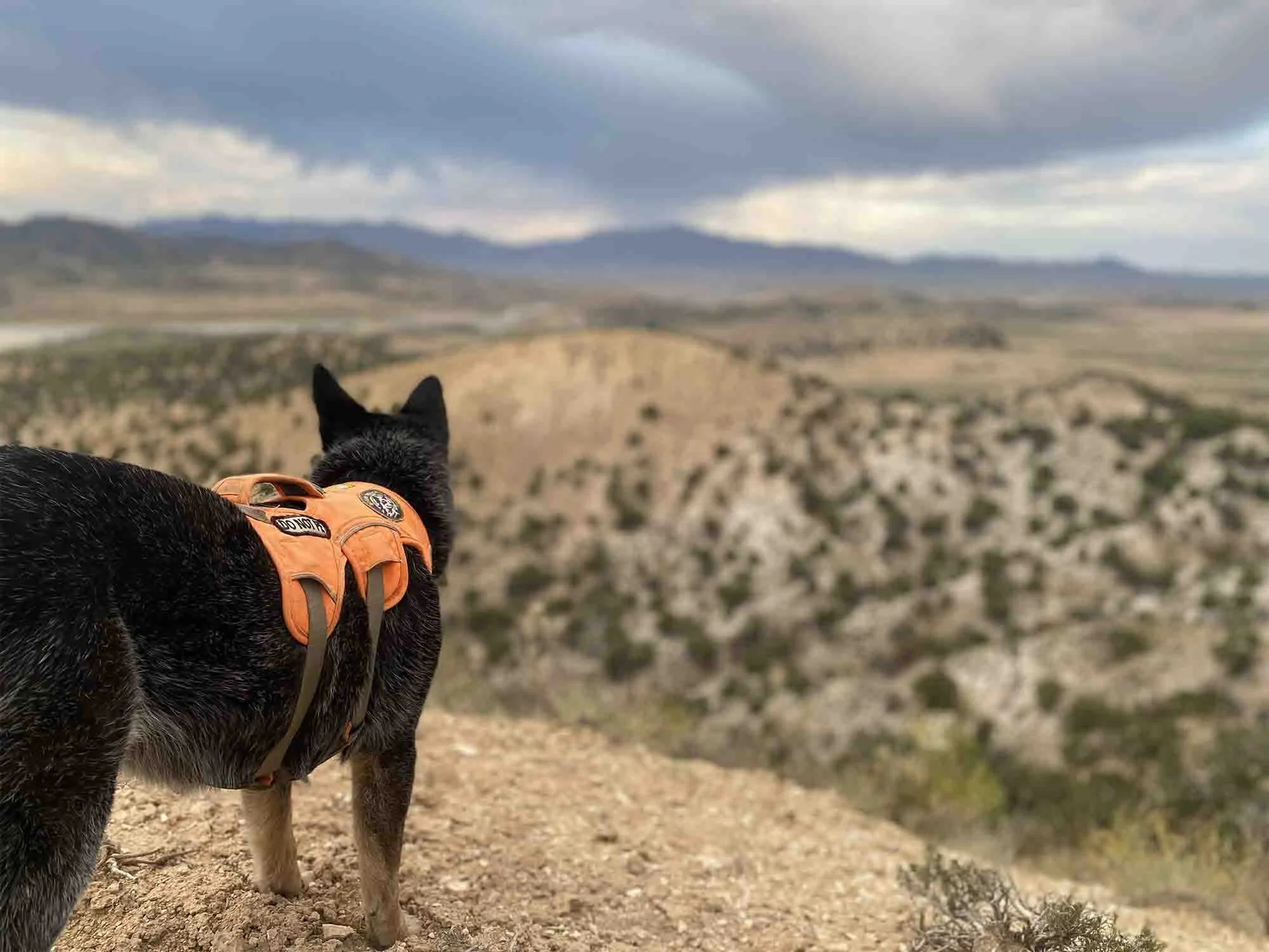
Researching wildlife connectivity
New studies are being carried out to collect genetic data on mountain lions, desert bighorn sheep, and bobcats to assess indicators of connectivity like cross-highway breeding and current wildlife movement across SR 62. Data will allow researchers to assess the long-term effect of the crossings and how they increase wildlife movement through this corridor. Rescue dogs are joining wildlife biologists in the effort to track scat.
This wildlife monitoring project is a partnership between Wildlands Network and the Mojave Desert Land Trust.
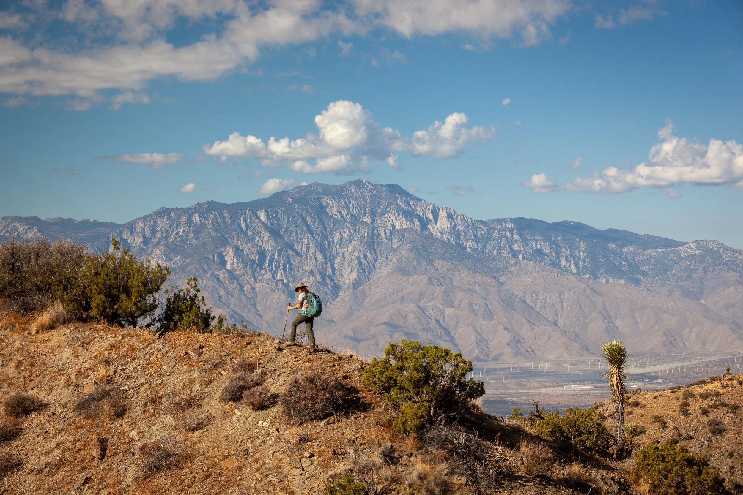
Meet the biologist leading wildlife surveys for the crossings
Dr. Christina Aiello is conducting wildlife surveys for the State Route 62 Wildlife Crossing Project. Working with the Mojave Desert Land Trust and other researchers, she is gathering evidence for how animals move across the public lands on either side of the highway, helping strengthen the scientific basis for crossings that could reconnect long-divided habitat.
Sniffing for Solutions: Rescue Dogs and Desert Wildlife Crossings
Near Joshua Tree National Park, two rescue dogs are sniffing out mountain lion and bobcat scat to help us understand how Highway 62 divides wildlife populations, and how crossings can reconnect them.
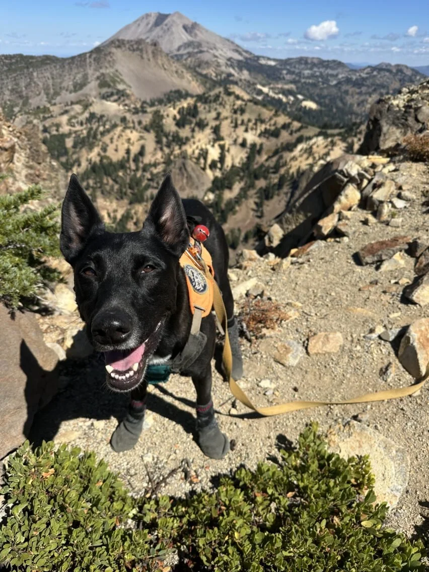
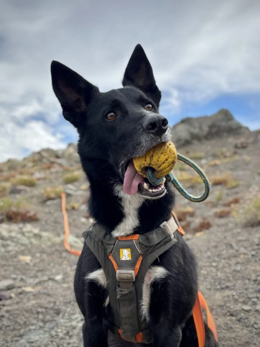
Siska and Merlin of Rogue Detection Dogs. Photos: Forktailed Media.
Frequently asked questions
-
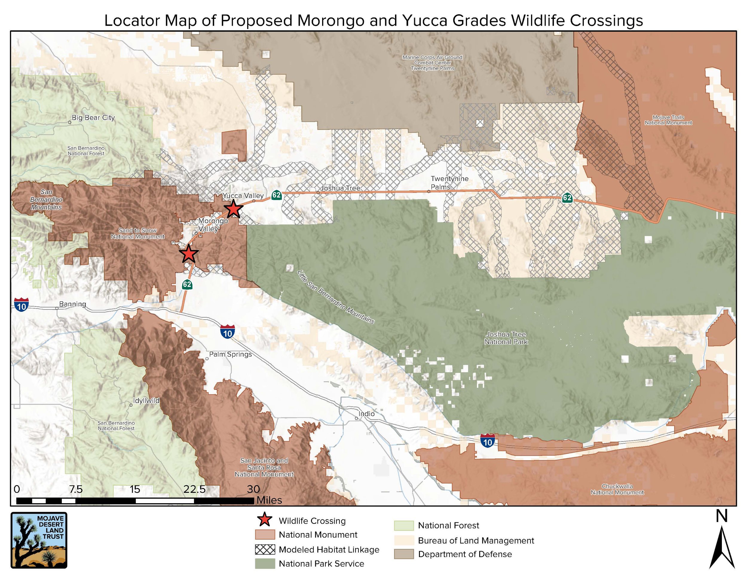
The Mojave Desert Land Trust (MDLT) is leading a project to plan two proposed wildlife overpasses on State Route 62. The crossings would reconnect habitat between Joshua Tree National Park and Sand to Snow National Monument, linking the Little San Bernardino and San Bernardino Mountains across an elevation range of more than 10,000 feet. State Route 62 now cuts through this connection, limiting wildlife movement between the two mountain ranges. By carrying native habitat over the highway and guiding animals toward safe passage, the project would restore long-established movement routes, reduce wildlife-vehicle collisions, and support healthier desert ecosystems.
-
State Route 62 has become an almost complete barrier to wildlife movement. Traffic has increased with regional growth and a doubling of visitation to Joshua Tree National Park in the last decade, while development and concrete medians have made safe passage increasingly difficult.
Wildlife are regularly killed crossing the highway. A 2021 study documented 232 animal carcasses from 14 different species in one year. A portion of this study occurred during the Covid shutdown with lower-than-average traffic, so actual death tolls are expected to be much higher. To develop a comprehensive understanding of animal movement and mortality in the vicinity of the proposed crossing sites, Wildlands Network researchers are leading a long-term study to document wildlife movement as well as wildlife-vehicle collision rates.
The highway also separates animals from food, water, refuge, and potential mates, reducing movement and genetic exchange between populations. This is especially urgent for the threatened San Gabriel-San Bernardino Mountains and Eastern Peninsular Range mountain lion populations, which meet near SR 62 and are at risk of extinction. The loss of such apex predators can trigger a trophic cascade, leading to disruptions in other species and ecosystems. Connected habitat helps wildlife adapt to climate change and recover from fires and floods.
-
The two proposed crossings would be located on State Route 62 between Desert Hot Springs and Yucca Valley. The Morongo Grade crossing is proposed on Bureau of Land Management property in Riverside County, while the Yucca Grade crossing is proposed on MDLT property in San Bernardino County. Both proposed locations lie within a stretch of SR 62 that the California Department of Fish and Wildlife has identified as an significant barrier to wildlife movement.
-
The project is currently in the planning phase, which will run through 2029. No construction date has been set. Current work includes surveying and mapping, geotechnical and environmental studies, preliminary engineering and cost estimates, stakeholder involvement, tribal consultation, and public information.
Wildlands Network is conducting wildlife monitoring through spring 2029 to establish a baseline for measuring changes in wildlife movement, genetic exchange, and collision rates after construction.
Designs are expected to reach 65% completion by the end of 2028. Once planning is complete, MDLT and its partners will seek funding to build the crossings.
-
The crossings are designed to make State Route 62 safer by guiding wildlife away from traffic and toward protected passage over the highway. Wildlife-vehicle collisions kill or injure tens of thousands of people nationwide each year, as well as millions of animals. When paired with fencing, wildlife crossings have reduced collisions by as much as 90% in some locations.
-
The crossings are expected to benefit a wide range of wildlife, including desert bighorn sheep, mountain lions, black bears, mule deer, desert tortoises, badgers, bobcats, coyotes, gray foxes, burrowing owls, smaller animals, and pollinators.
-
The crossings are envisioned as broad, earthen overpasses that continue the surrounding landscape across the highway rather than resemble conventional road bridges. Native plants, rocks, and other natural cover may provide familiar habitat, while gradual approaches will allow wildlife to move easily across. Barriers will help shield animals from highway noise and headlights. Final designs have not yet been selected, and the two crossings may differ based on the terrain and engineering needs at each location.
-
Animals already follow established travel routes through this landscape. The overpasses will be placed where wildlife now approach or attempt to cross SR 62. Fencing would direct animals away from traffic and toward the safer route, while sloped escape ramps known as jump-outs could help animals that enter the highway corridor get out. Young animals may also learn these routes by following their parents.
-
The Morongo and Yucca Grades were selected after years of research into wildlife movement across the region. The larger habitat connection was first documented in 2005, and a 2021 Caltrans-funded study used cameras, tracks, scat, and roadkill records to examine where diverse species occur alongside the highway and where animals often die while attempting to cross. The study found that both grades acted as nearly complete barriers and recommended an overpass at each location. The exact sites and designs will be refined as planners evaluate wildlife habitat, terrain, geology, utilities, highway conditions, and surrounding properties.
-
MDLT is leading the project in partnership with Caltrans, the Coachella Valley Conservation Commission, and the Mojave Desert Resource Conservation District. Tribal groups, wildlife agencies, scientists, technical consultants, and other local stakeholders will also contribute to the planning and review process. The planning phase is supported by $5.5 million from the California Wildlife Conservation Board, $512,000 from the Coachella Valley Mountains Conservancy, and $100,000 from Caltrans. These funds cover planning and design, but not construction. Additional funding will be needed before the crossings can be built. Wildlands Network is conducting wildlife surveys.
-
MDLT will share project updates, wildlife survey findings, and opportunities for public participation through its website, newsletters, social media, and community events. Future opportunities may include webinars, public presentations, educational materials, and a community-science project that would allow residents to help document wildlife killed along the highway. Visit mdlt.org and sign up for MDLT’s emails to follow the project and learn when new opportunities become available.
For questions, please email info@mdlt.org. For media enquiries, please contact our communications team:
Jess Dacey, Director of Communications: jessica@mdlt.org / 760-366-5440 ext 239
Jessica Graybill, Communications Manager: jgraybill@mdlt.org / 760-366-5440 ext 240


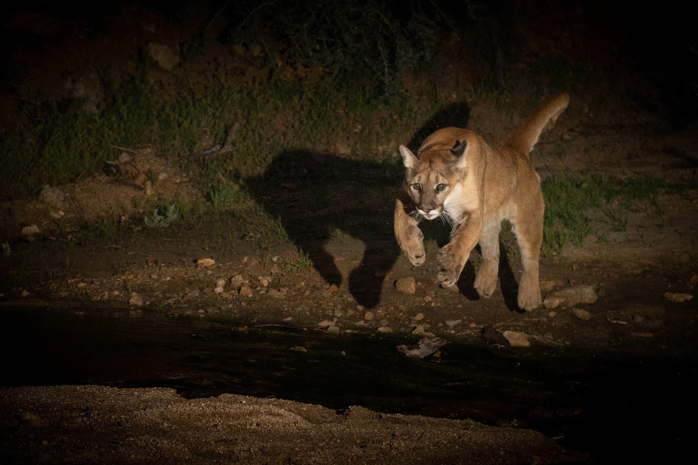
Photos: Dan Potter and John Sullivan.
Sign up to receive news and get involved in the crossings project.
For questions, please email info@mdlt.org. For media enquiries, please contact our communications team:
Jess Dacey, Director of Communications: jessica@mdlt.org / 760-366-5440 ext 239
Jessica Graybill, Communications Manager: jgraybill@mdlt.org / 760-366-5440 ext 240