Become a community scientist!
Community science, also known as citizen science, is the collection and analysis of data relating to the natural world by members of the general public, typically as part of a collaborative project with professional scientists.
Through community science, people around the world take part in real scientific studies using set protocols. Every year community scientists contribute thousands of observations to a variety of studies, allowing new questions to be asked of the natural world.
Interested in taking part? The Mojave Desert Land Trust has put together resources to help you get involved in this global effort.
From studying Joshua trees to light pollution to bird species and more, there are so many ways for you to put your passion for the earth to work.
This presentation by our Outreach team explains what community science is and how you can get involved:
Yucca Weevil Watch

Have fun, get outdoors, and contribute to scientific inquiry with just the power of your phone: join Yucca Weevil Watch 2023! This community science project uses the iNaturalist app to document the presence of yucca weevils (Scyphophorus yuccae) in Joshua trees (Yucca brevifolia) throughout the Morongo Basin. Join our community effort to document observations of trees with evidence of yucca weevil damage. Everyone can be a scientist!
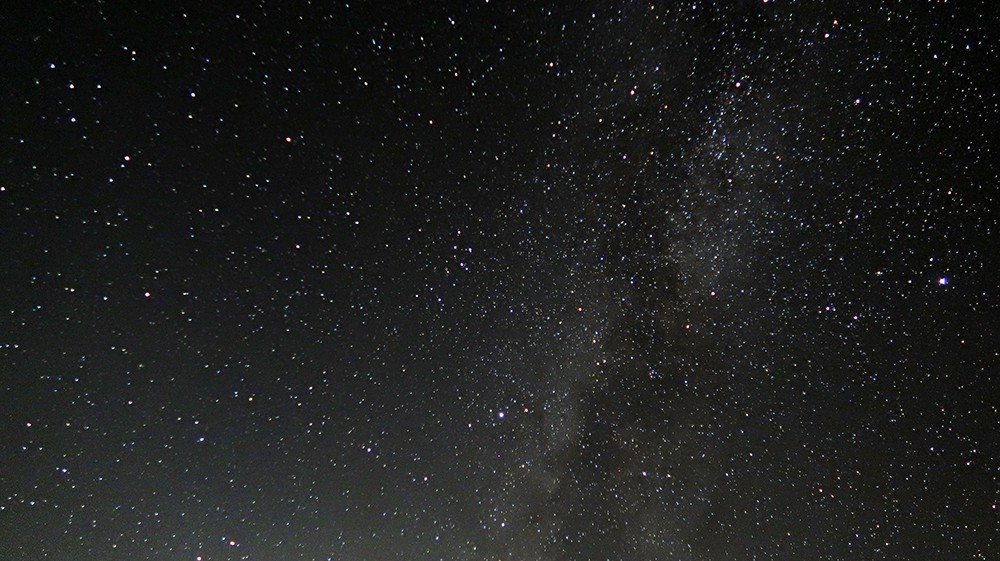
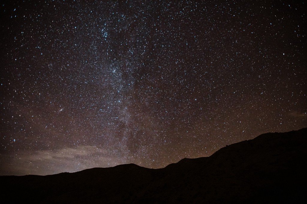
Night sky conservation
MDLT’s WISDOM interns surveyed night sky quality in Mojave Trails National Monument to obtain darkness measurements. By downloading the same apps and uploading your own data, you can help raise public awareness of the impact light pollution has on energy consumption, wildlife habitat, and human health. You can also use the interactive map to find dark sky places to visit. Uploading data to these projects can help federal agencies, conservationists, and the global community understand and protect dark skies now and for generations to come.
-
An international community science campaign to raise public awareness of the impact of light pollution by inviting people to measure & submit their night sky brightness observations.
Supported Platforms: Internet Based Website
Suitable Ages: Age 16 and older
This is the website that the DNS WISDOM interns use to upload SQM measurement points. The website includes demos for participating in the project.
-
This app allows community scientists to estimate how many stars they can see and how much light pollution there is in the night sky. By participating, you help scientists track changes in artificial sky brightness in urban and rural areas. They hope to map changes in light pollution for the long term.
Supported platforms: Android and iOS
Suitable ages: All
Loss of the Night on SciStarter.org
MDLT’s WISDOM Dark Night Sky interns also used this app for uploading measurement points. It uses interactive maps.

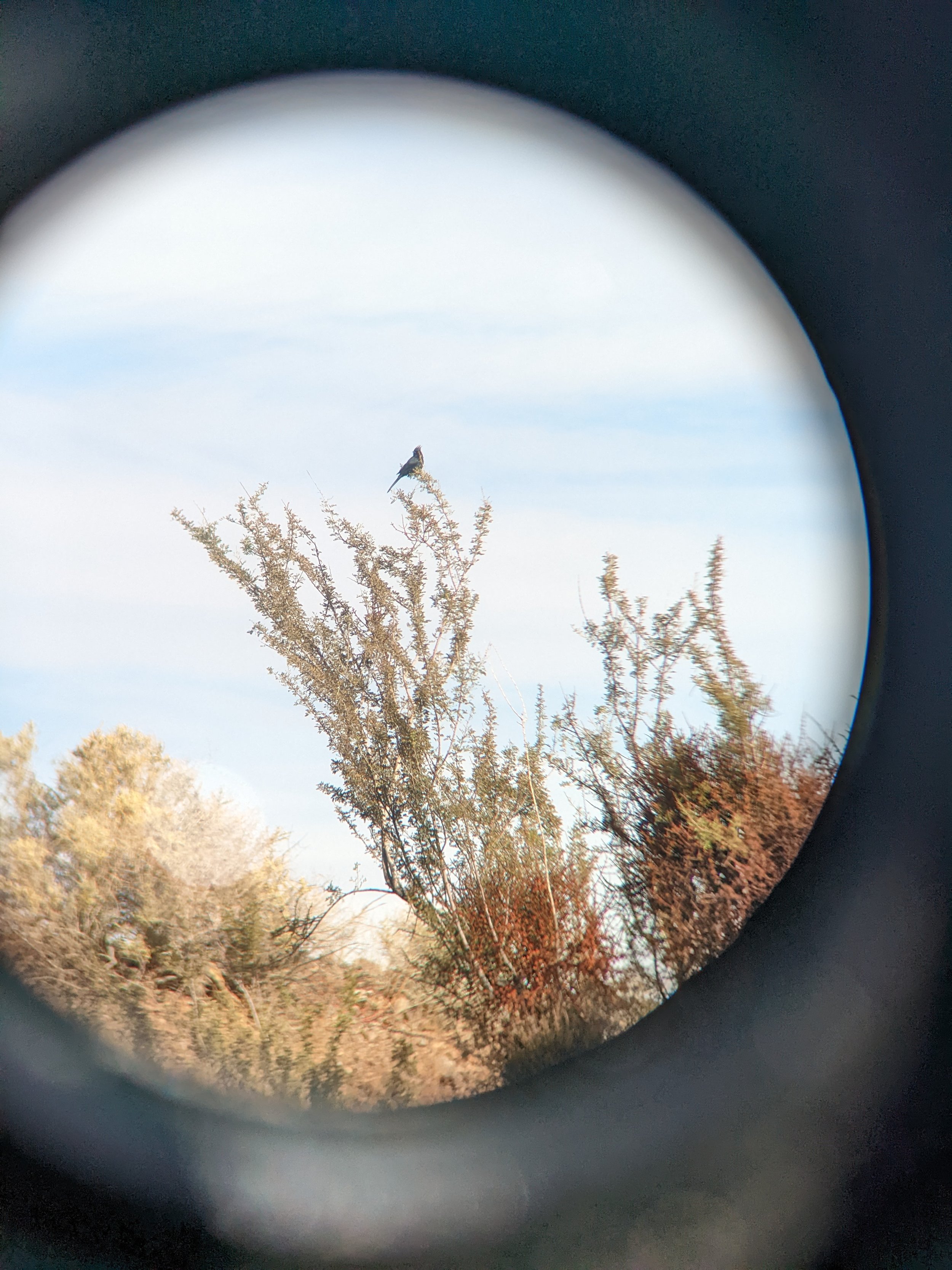
You can join in the eBird community science programs created by Cornell Lab of Ornithology. Our collective information helps our global community study bird species worldwide!